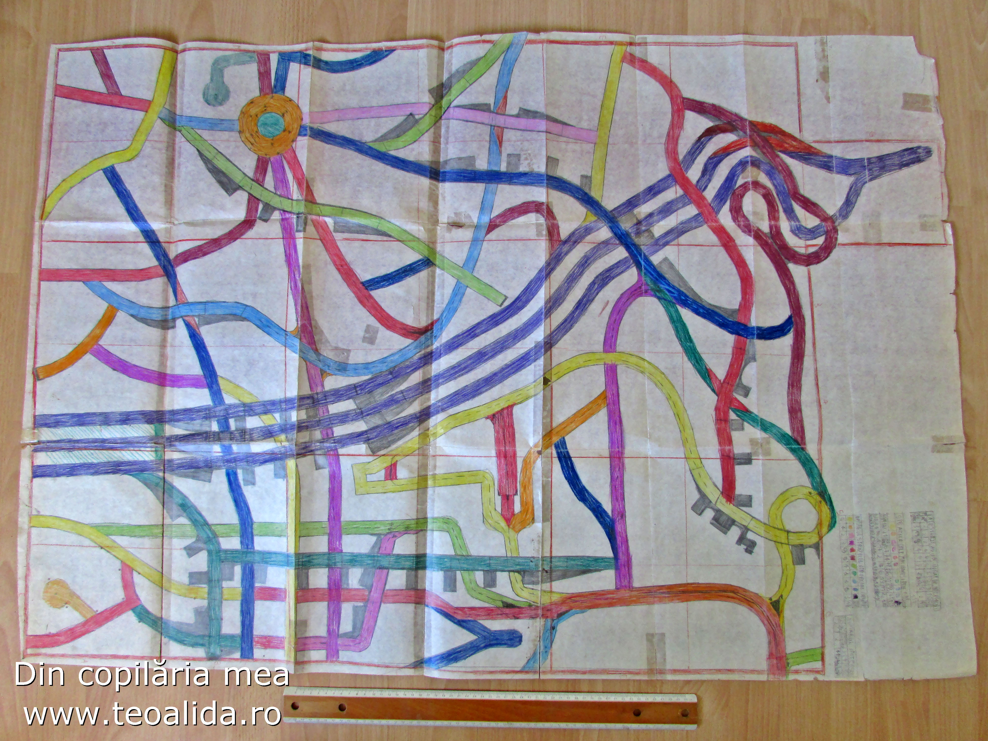
The hobby for designing maps have a long history. Starting from 6 years old I was drawing random roads on paper and coloured them in various colors (example). The first time I designed a map of a real city was at age of 14, in 2003 I made on paper a map of my city downtown (Ploiesti) with a special attention given to historical buildings.
I had a book from 1981, a guide of Ploiesti with street directory, points of interest, etc, including one citywide map with streets only and separate maps for each neighborhood that included also apartment blocks and their numbers.
Map of Ploiesti in AutoCAD + Paint (2005-2007)
In October 2004 we connected to neighborhood LAN, allowing me to communicate freely with people for first time, in February 2005 we also added internet connection. While chatting on LAN I noticed many people who do not know block numbers and saying “3rd block from bus station”. That times Google and Yahoo Maps in case of Romania did not had any streets inside cities but only national roads. There was no digital map available that included block numbers.
I had free time and realized that I have a chance to do something helpful for my city. In November 2004 I made a map of my neighborhood, and it was so appreciated in our LAN that I decided to extend project for whole city in 2005, I designed voluntarily 18 separate maps for each neighborhood at resolution of 2 pixels per meter, plus a map with entire city at 0.5 pixels per meter having all streets and names for major streets (inspired from the 1981 book).
Example: one of the 18 neighborhood maps made in 2007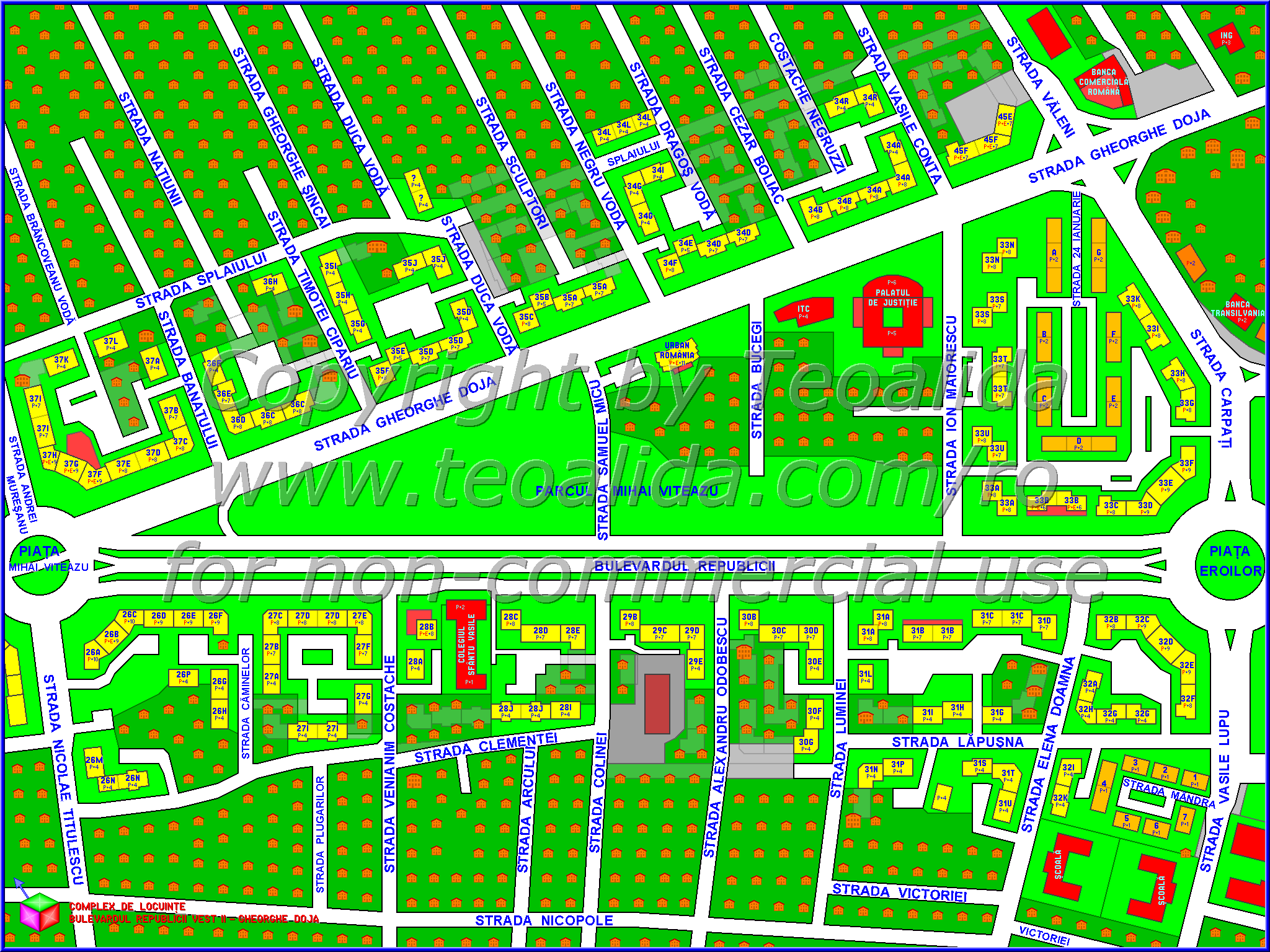
Procedure of map design was a bit too complex: I was drawing street and buildings outlines in AutoCAD based on 1981 book, export to Paint and make a draft map which I printed and go around city to add more details and correct mistakes, return home, improve map in AutoCAD, export again in Paint. Colors, block numbers and house symbols were not part of DWG file, they were added in Paint.
I distributed maps freely in PNG format via my LAN DC++ hub used for file sharing and chat. Did not shared DWG files with anyone.
The results: I wasted FEW MONTHS making this digital artwork that could be also used to navigate through city, find specific blocks, etc. But that was all, the map had limited use and couldn’t be used for more professional things such as making measurements or GPS navigation systems. Customizing for individual customers was difficult.
In 2007 I released a new versions of Ploiesti neighborhood maps with some corrections, after this I designed maps for 10 small towns around Ploiesti, one for each town including the areas with apartment buildings, but without block numbers, these maps had no practical use but just artistic value.
In 2008 I made a new citywide map with streets only, first time using satellite photo as reference, reaching an accuracy level never seen before.
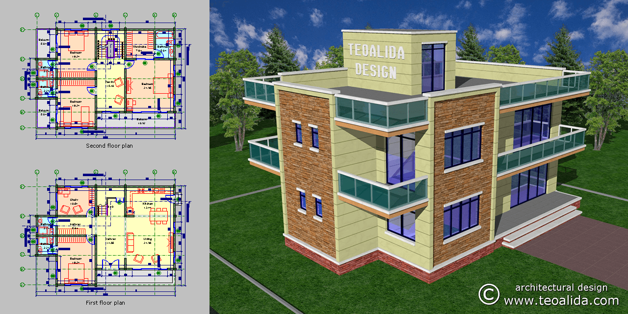
Beside maps I also made floor plans of common apartment blocks, and an Excel table that does estimate number of blocks and of apartments, extended this project to several more cities from Romania without making maps for, including Bucharest.
This hobby evolved in 2008 into studying worldwide architecture, designing my own building concepts and dream to move to Singapore.
In 2006 I got a job offer from www.romaniadigitala.ro impressed by my knowledge about city maps and offered to employ me to make GPS maps. Being underage, getting employed was a bit difficult, they also offered paying me for the right to use of maps already done, but although I could meet people (strangers) under parents’ supervision and get paid, my parents would not let the money in my hands, so I had no reason to charge money.
I made my website in 2009 and added the maps too in 2010. Now I was an idiot, I put the maps for free download without being aware that there might be companies able to pay for maps, such as taxi drivers, pizza deliveries, door-to-door services, etc. Even if I could make paid download, the smartphones and free online maps appeared (Google Maps and OpenStreetMap), reducing my potential earnings.
Map of Singapore in AutoCAD (2009-2010)
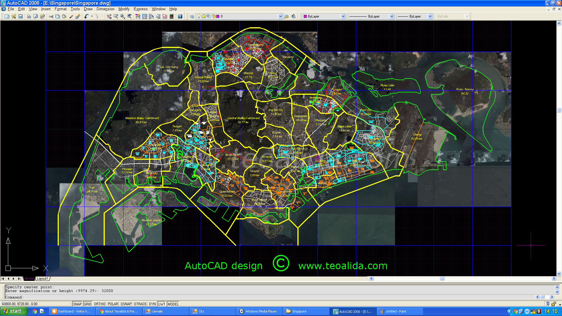
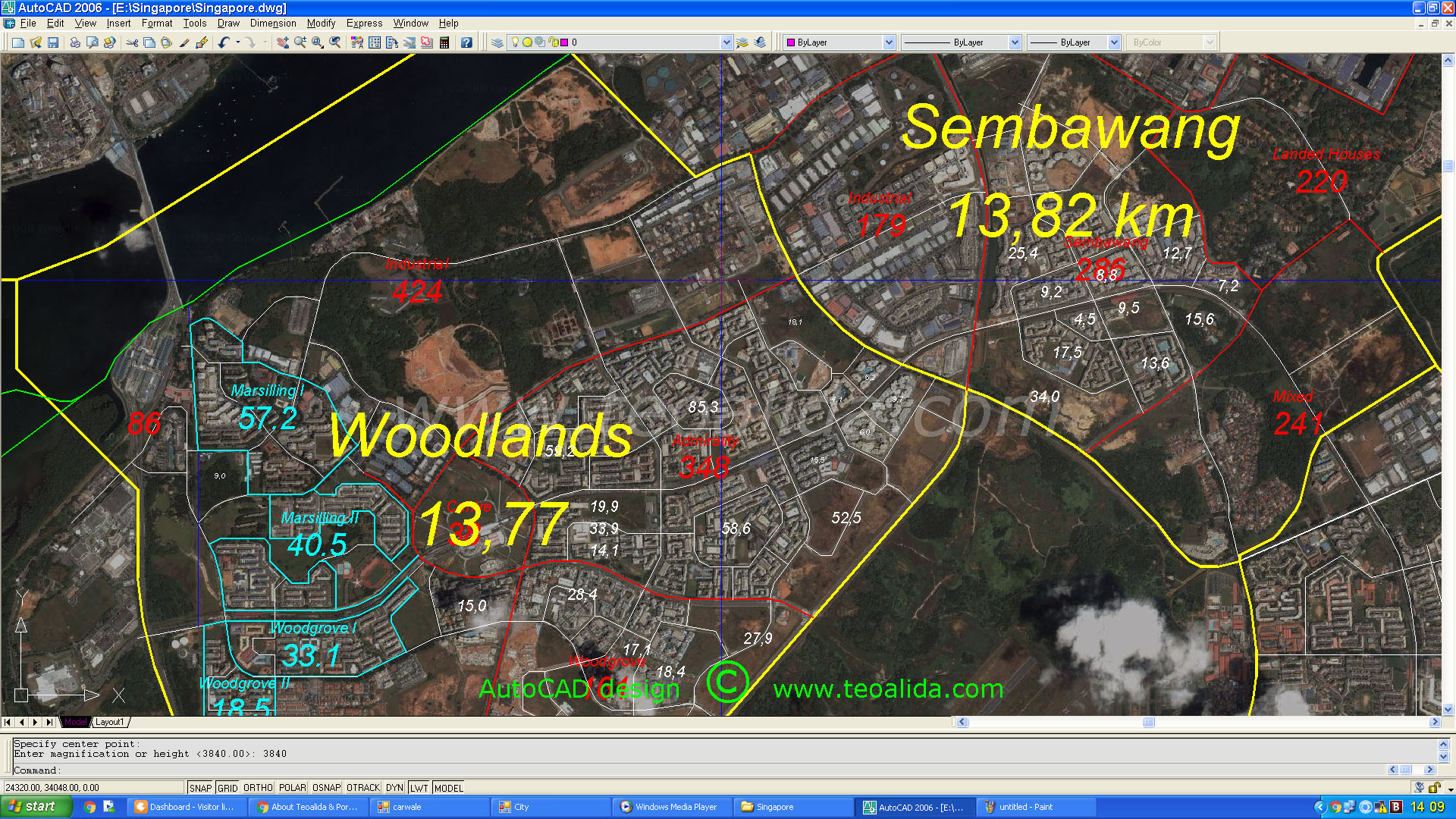
In 2009 I started researching Singapore, making the Database of HDB blocks with estimated number of units, and also a map of Singapore in AutoCAD over Google Maps satellite photos. I was drawing street axis as well as planning area borders and coastal outline.
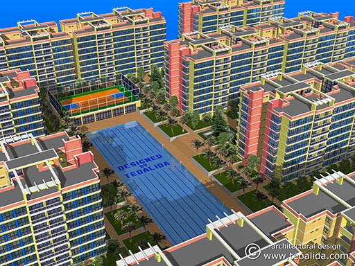
I did not intended to distribute or commercialize the map or database, it was a voluntary project for personal research of measuring area of various land parcels in HDB estates to estimate housing density and use the results in designing own apartment models.
I ended my research in 2011, leaving the map at the state seen in below photos.
I published the incomplete HDB Database on website for first time in 2012, resumed working in 2014 and finalized the database in 2015 to offer it as paid service for professional use, it has been purchased by several real estate agencies, home insurance companies, telecommunication, door to door services, etc.
I published the AutoCAD map for first time in January 2016 to show you that I can design maps too, to see if anyone is interested, how such AutoCAD map could be used and what details should be added on map. If there is sufficient demand from multiple people I will revive the project and offer as paid download.
Potential problems: my idea is to design a map in AutoCAD and allow anyone to purchase DWG or PDF file at an affordable price. Price may rise once I add more details. Due to rounding to save time, using multiple straight segments to draw curves, all roads will be few meters off their real position. What accuracy level is needed to make customers happy and not spend too much time? Such map may be good for orientation only.
Singapore does already have maps like www.onemap.sg and www.streetdirectory.com, pretty detailed having block numbers and a lot of places of interest, they are good for orientation making my map almost useless, but they do not have option to download map, nevermind editable DWG format. URA do have very detailed maps in DWG format available for purchase by professionals (at high price), and a map designed by 1-person in AutoCAD will never compete with the official maps done by government authority.
If you ate interested in AutoCAD map, DO NOT ask about completion status or what is included on the current map… most likely I have to trash it and start over designing a new map according your requirements:
Do you need axis line of all streets in Singapore? This would be easy to do.
Do you need building outlines? Theoretically is possible to draw them over satellite photo, but will take too much time considering how complex are shaped the HDB blocks.
Do you need anything else that do not come in my mind? Tell me…
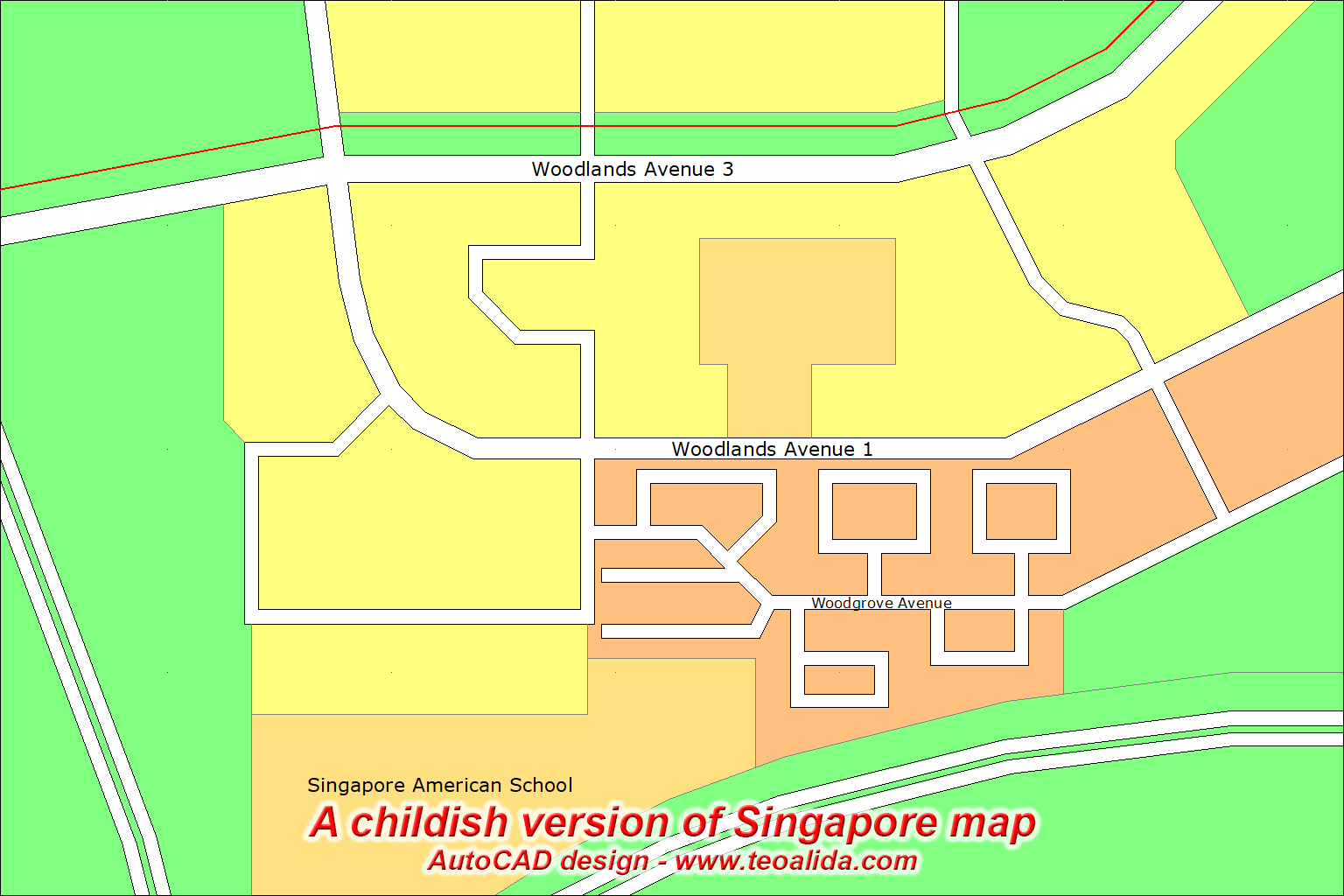
In June 2017 someone asked me to design a map with street axis, border and colors that indicate land use (HDB, private, educational, industrial, park, water, etc). This remind me of the Ploiesti city map designed in 2005. See a SAMPLE:
Over next 2 years several people contacted me intending to buy an AutoCAD map, but all them turned to be students with low budget. Some lazy people did not even told me exactly what details should be included on map. Whenever professionals will come in the future, the effort required to draw the map will not justify if it will get only few sales per year.
In conclusion: Singapore AutoCAD map is a DEAD project!
New AutoCAD map of Ploiesti city (2018)
In 2012 I realized that AutoCAD 2007 introduced PDF export, this opened a potential new era in making maps (previously I was using AutoCAD 2002 and 2006).
Over years been contacted by several customers looking for a high-resolution map to display on wall in their office, case in which my 2005-2007 maps made in Paint maps were unusable, Google Maps also unusable. Number of visitors per day in Romanian section of my website was low, so potential sales of map were too low to worth my time making new PDF maps.
As the number of visitors rose in 2017 and discovering that I can promote the map via Facebook groups, I decided in January 2018 to return to Romania. I opened AutoCAD map made in 2008, reduced streets width, then I spent about 100 hours to add buildings between March and June, and exported PDF. See below final map:
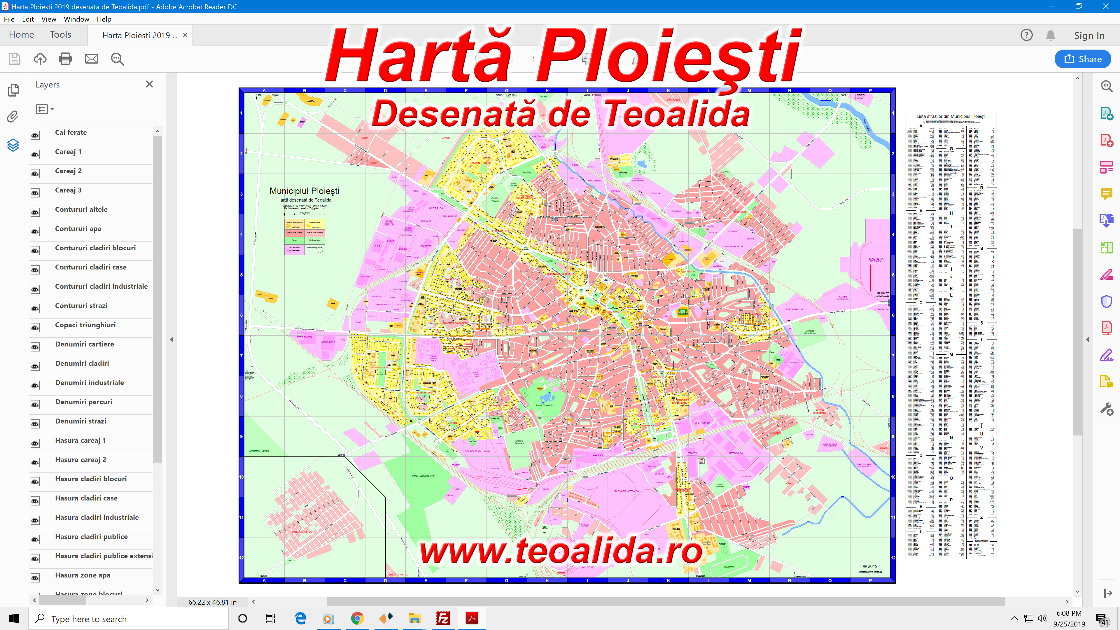
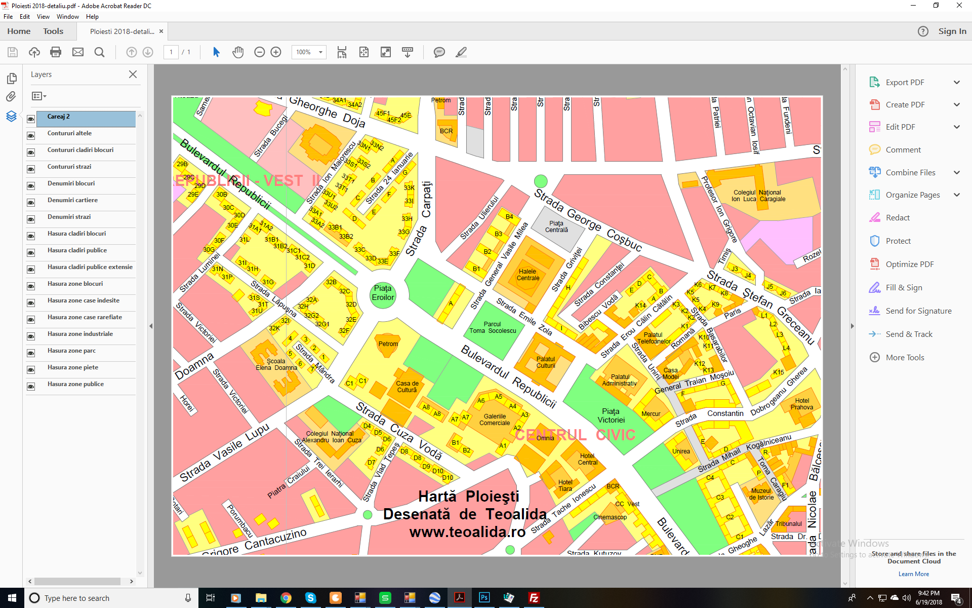
Ploiesti city map cover an area of 8192 x 6144 meters (base-2 FTW!) and can be printed on paper up to 210 x 160 cm (scale 1:4000). Since all elements are included in DWG file, it can be quickly customized in terms of colors, line thickness, add your company logo, etc.
Price: 500 RON (about 125 USD) plus printing cost (50 RON / square meter).
Interactive maps with buildings in Google Maps
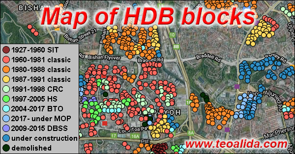
In September 2017 I discovered Google Fusion Tables, a FREE experimental application where I can import CSV files containing latitude and longitude, and some other data, to display it as icons / markers / pushpins on map.
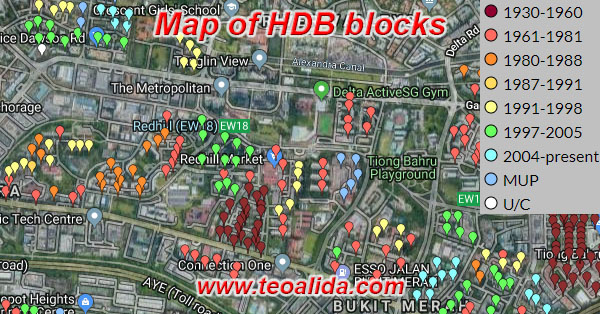
I imported Singapore HDB Database into Google Fusion Tables, creating HDB Interactive Map.
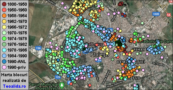
In January 2018, shortly before drawing Ploiesti city map in AutoCAD, I compiled a database of Ploiesti apartment blocks similar with HDB one (block number, street address, number of floors, apartments, GPS coordinates). It took about 20 hours for ~1800 buildings, and displayed information in Google Fusion Tables. Posting it on Facebook groups, it became a sensation, being an unique project never done before in Romania.
Over next year I got few requests from people living in other cities to draw maps in AutoCAD or interactive maps in Google Maps for other cities. But POOR SALES of Ploiesti AutoCAD map, made me to decide to NOT draw any more maps in AutoCAD, neither for Romania or Singapore. But I continue compiling building details in Excel for other Romanian cities, which takes 5-10x less effort than drawing a map in AutoCAD and have more usage potential, displaying data on an interactive map help regular people with FREE information, generate hundreds likes when posted on Facebook, and there is also a potential to sell Excel database to real estate agencies.
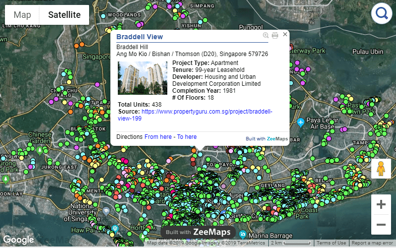
Google announced closure of Fusion Tables on 3 December 2019. In October 2019 I moved to ZeeMaps, a paid service that provide 31 colors to choose from, as well as filter option to display only buildings matching specific strings of text or having values (like number of floors) greater than specific #.
hi,
I am an interior design student, and we are currently designing a sustainable building in cantonment road (Singapore), we need a site analysis plan, would be nice to use an autocad plan of singapore as well.
sincerely
Chiara
Can you be more specific what details should be included in this AutoCAD map to be usable for you?
Hi Teoalida,
I am an architecture student and I am doing a research on Singapour’s port infrastructure : I need port & petrochemical installations, and all kind of transport infrastructure linked to it . I was wondering if you had this done already in CAD, or may be a part of it.
Regards
Charlotte
How these petrochemical installations should be draw in AutoCAD? what level of details? If I did not had this already done, can’t do it right now? But I am afraid that installations are bit difficult to draw using satellite photos.
hey, i am a architecture student, and i need the map of Singapore in DWG to autocad to do a research of the city itself. how can i get it from you?
Same question for you: what details should be included on the map?
But since everyone who show interest is a student, we all know how little students pay, so I will never able to recover my investment to make such map.
hi teoalida, there are tons of resources about singapore available for free. this information is also much more accurate (in terms of physical mapping, as well as being up to date in time) than what you are doing using google maps. also, there exists qgis, backed by an open source community dedicated to making information available to everyone instead of attaching a price tag to knowledge. i’d suggest that you try to gain revenue elsewhere as the knowledge/market here is already saturated and very well documented. perhaps one of the other 13 countries you document would be a good area of focus? all the best!
The map project is dead, I already realized that all AutoCAD / graphic design projects are NOT profitable. My revenues are 90%+ from sale of databases.
PS: you left an invalid email.
Your passion was developed when you was a child. So, I think you can develop it more. The design can bring a lot of advantages. I hope that you can keep doing it.